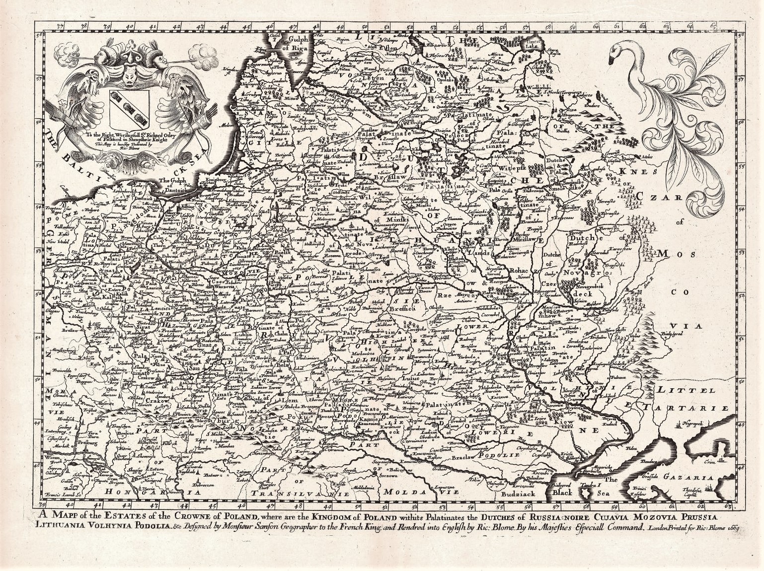
1669 R. Blome „A map of the Estates of the Crowne of Poland…”
Richard Blome (1635-1705)
ATR žemėlapis 1669 m.
Londonas
29 x 40,3 cm
ID: 2114
Kategorija: 1660-1680 > Abiejų Tautų Respublika > Blome, Richard > Didžioji Britanija > Vidutiniai
„A Mapp of the Estates of the Crowne of Poland, where are the Kingdom of Poland withits Palatinates, the Dutches of Russia-Noire, Cujavia, Mozovia, Prussia, Lithuania, Volhynia Podolla &c. Designed by Monsieur Sanson Geographer to the French King and Rendered into English by Ric: Blome…,”
Žemėlapis iš ” A Geographical Description of the Four Parts of the World Taken from the Notes and Workes of the Famous Monsieur Sanson, Geographer to the French King, and Other Eminent Travellers and Authors: To which are Added the Commodities, Coyns, Weights, and Measures of the Chief Places of Traffick in the World; Compared with Those of England, (or London) as to the Trade Thereof. Also, a Treatise of Travel, and Another of Traffick. The Whole Illustrated with Variety of Useful and Delightful Mapps and Figures…”
Pirma žemėlapio laida
K14/1

