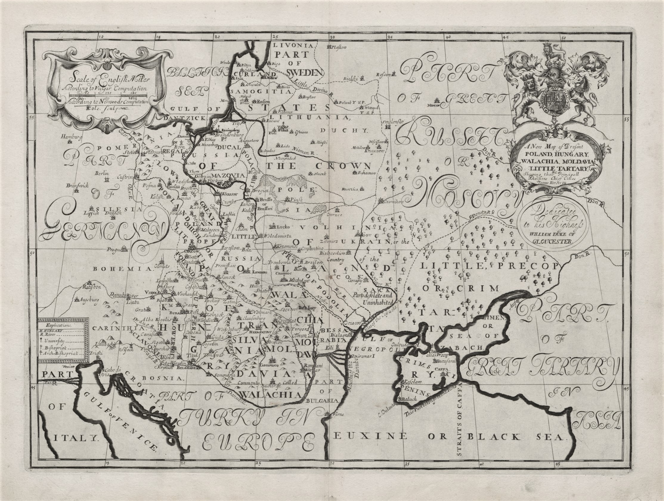
1700 E. Wells „A New Map of Present Poland…”
Edward Wells (1667–1727)
ATR žemėlapis 1700 m.
Oksfordas
37 x 49 cm.
ID: 2198
Kategorija: 1700-1720 > Dideli > Didžioji Britanija > Sarmatija > Wells, Edward
„A New Map of Present Poland, Hungary, Walachia, Moldavia, Little Tartary &c.Shewing thier Principall Divisions Chief Cities, Towns, Rivers, &c”
Iš „A new sett of maps both of antient and present geography: : wherein not only the latitude and longitude of many places are corrected according to the latest observations, but also the most remarkable differences of antient and present geography may be quickly discern’d by a bare inspection or comparing of correspondent maps, which seems to be the most natural and easy method to lead young students (for whose use the work is principally intended) unto a competent knowledge of the geographical science : together with a geographical treatise particularly adapted to the use and design of these maps ”
Spausdino „Theater”
