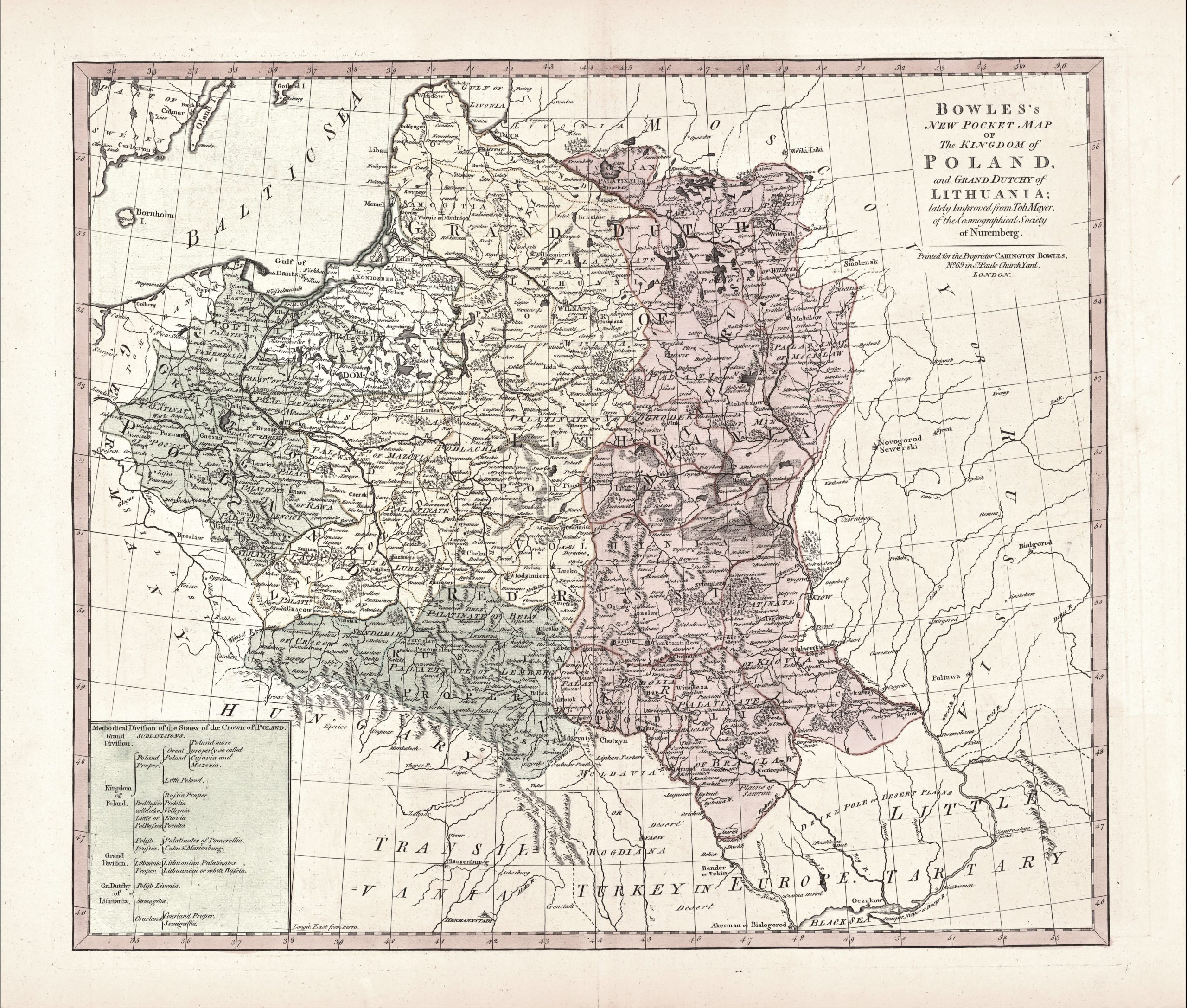
1775 G. Bowles „Bowles New pocket Map of the Kingdom of Poland…”
Carington Bowles (1724-1793)
John Bowles (1701-1779)
Johann Tobias Mayer (1723-1762)
ATR žemėlapis 1775 m.
45,7x 53.7 cm.
ID: 2128
Kategorija: 1760-1780 > Abiejų Tautų Respublika > Bowles, Carington > Bowles, John > Didžioji Britanija > Mayer, Johann Tobias > Palairet, Jean
„Bowles New pocket Map of the Kingdom of Poland and the Grand Dutchy of Lithuania: lately Improved from Job. Mayer. of the Cosmographical Society of Nuremberg” Printed for the Proprietor Carington Bowles in S.’Pauls ChurchYard .
1750 metų Johann Tobias Mayer žemėlapio perdirbinys.
Iš „Bowles’s Universal Atlas: Being a Complete Collection of New and Accurate Maps, of all the Known Countries in the World; displaying the Whole Surface of the Terraqueous Globe, Laid Down from Correct Surveys, New Discoveries, and Authentic Documents” London
Išleido J.Bowles ir C.Bowles . Bowles šeima aktyviai leido ir pardavinėjo žemėlapius 1714 – 1832 metais. Jų knygynas vadinosi „Black Horse Bowles”
K 46/2


