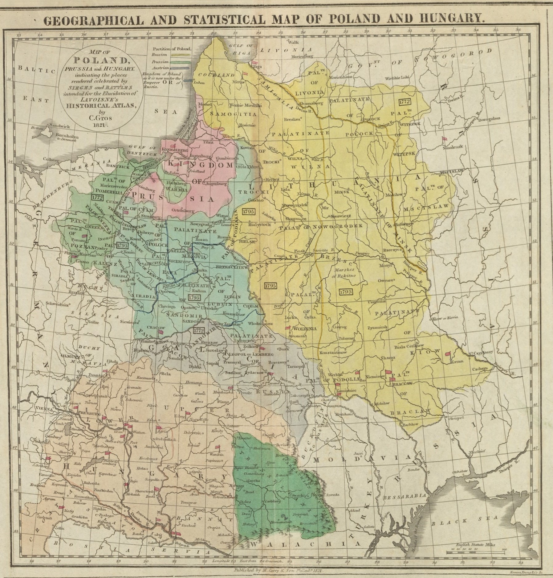
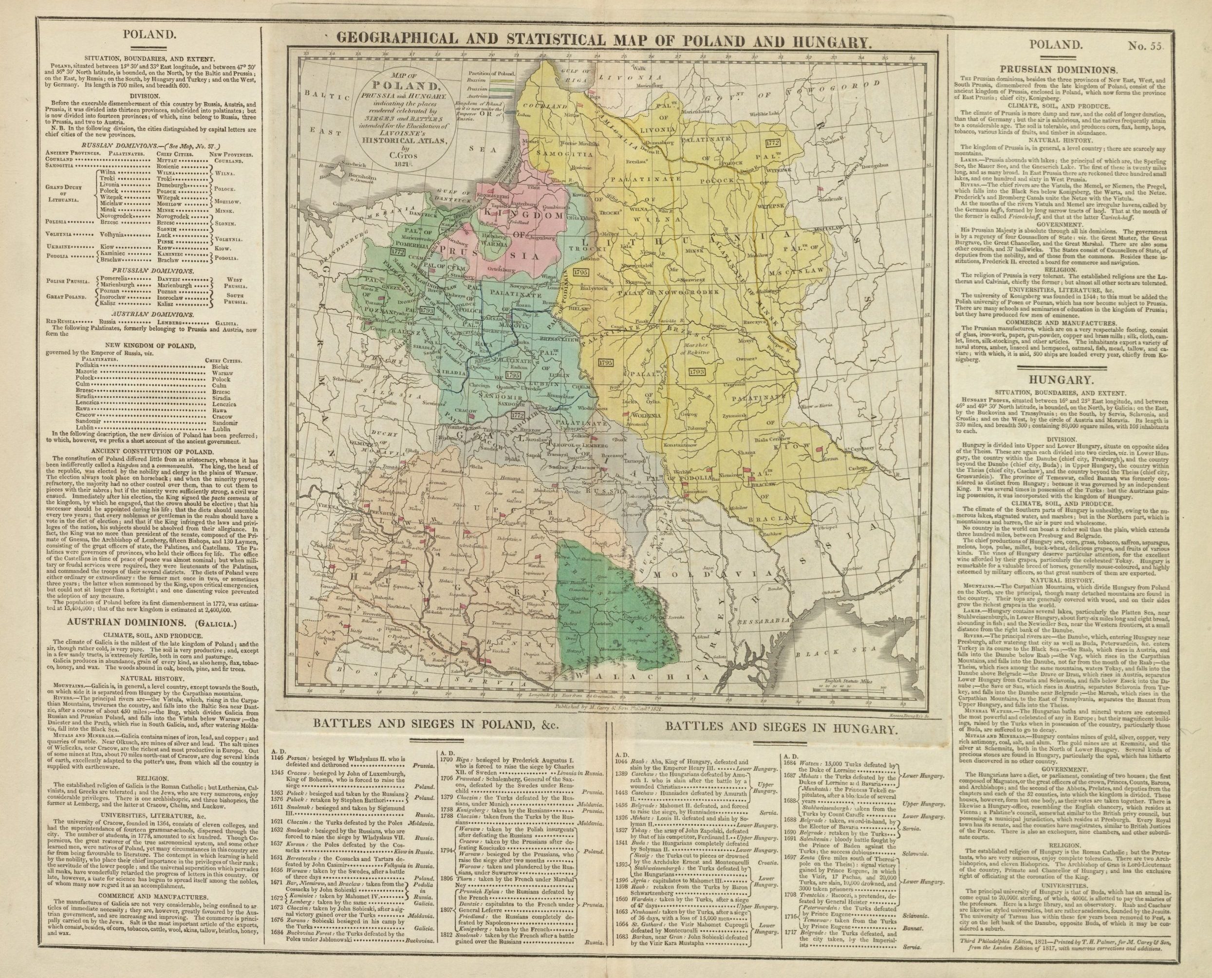
1821 M. Carey ” Geographical and Statistical Map of Poland and Hungary…”
Mathew Carey (1760-1839)
ATR žemėlapis 1821 m.
Filadelfija
43×53 cm
ID: 618
Kategorija: 1820-1840 > Abiejų Tautų Respublika > Carey, Mathew > Dideli > JAV
„Geographical and Statistical Map of Poland and Hungary.
Map of Poland, Prussia and Hungary indicating the places rendered celebrated by Sieges and Battles intended for the Elucidation of Lavoisne’s Historical Atlas”
Iš Lavoisne „A Complete Genealogical, Historical, Chronological, and Geographical Atlas”
Graveris T.H.Palmer