1829 J. Wyld I „A Map of the Kingdom of Poland…” 7
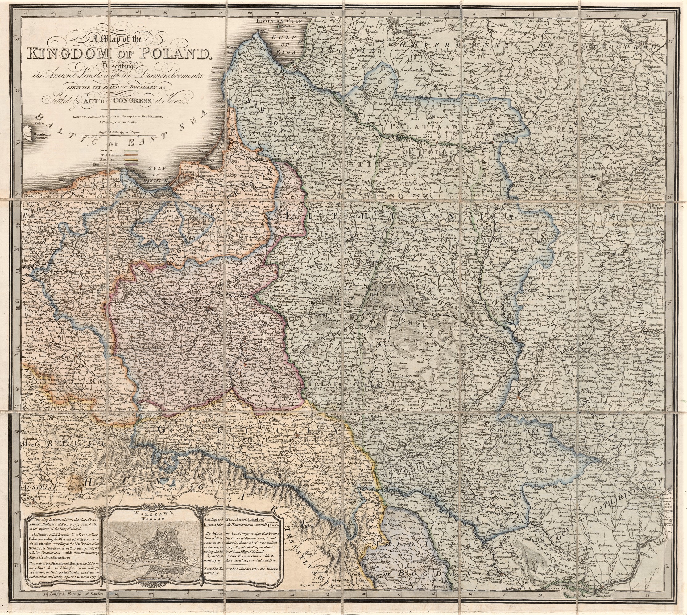
James Wyld (1790–1836)
William Faden (1749 – 1836)
ATR žemėlapis 1829 m.
Londonas
53×51 cm.
ID: 2550
Kategorija: 1820-1840 > Abiejų Tautų Respublika > Dideli > Didžioji Britanija > Faden, William > Wyld, James
„A Map of the Kingdom of Poland, describing it’s Ancient Limits with the Dismemberments Likewise Its Present Boundary As Settled by Act of Congress at Vienna”
Iš „New General Atlas”
Septinta žemėlapio laida – kartuše pasikeitė leidėjo pavadinimas į ” LONDON, published by JA.Wyld , Geographer to His Majesty 5 Charing cross January 1 1829″
K63/2
Jums taip pat gali patikti…
-
![1843 J. Wyld II "A Map of the Kingdom of Poland..." 11]()
1843 J. Wyld II „A Map of the Kingdom of Poland…” 11
James Wyld II (1812–1887) James Wyld ...
-
![1838 J. Wyld II "A Map of the Kingdom of Poland..." 9]()
1838 J. Wyld II „A Map of the Kingdom of Poland…” 9
James Wyld II (1812–1887) James Wyld ...
-
![1815 W. Faden "A Map of the Kingdom of Poland..." 6]()
1815 W. Faden „A Map of the Kingdom of Poland…” 6
William Faden (1749 – 1836) ATR...
-
![1803 M.R. Effendi "Kadimi Memalik-i Leh..."]()
1803 M.R. Effendi „Kadimi Memalik-i Leh…”
Mahmud Raif Effendi (1793-1804) William...
-
![1803 M.R. Effendi "Kadimi Memalik-i Leh..."]()
1803 M.R. Effendi „Kadimi Memalik-i Leh…”
Mahmud Raif Effendi (1793-1804) William...
-
![1799 W. Faden "A map of the Kingdom of Poland and Grand Dutchy of Lithuania..." 3]()
1799 W. Faden „A map of the Kingdom of Poland and Grand Dutchy of Lithuania…” 3
William Faden (1749 – 1836) ATR...


